
 English
 French
 Spanish
 Russian
 Arabic
 Italy
Italy
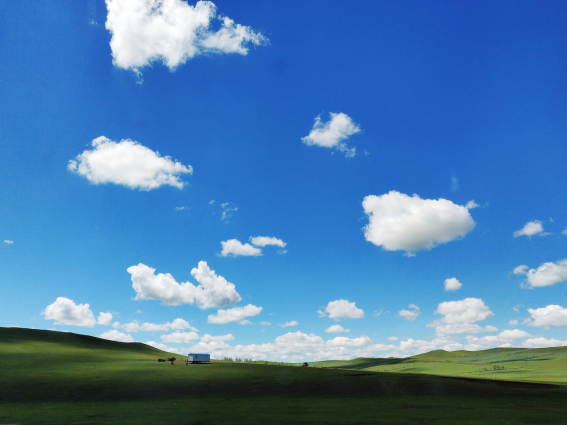
Hulunbuir
Inner Mongolia, China · Hulunbuir
“Emerald of the North · Grassland Paradise”
Contents
I. City Overview
II. Geography & Ecology
III. History
IV. Top Attractions
V. Cultural Heritage
VI. Ethnic Culture & Folk Customs
VII. Local Cuisine
VIII. Crafts & Specialties
IX. Getting There
X. Best Season & Itineraries
XI. Economy
I. City Overview
Hulunbuir lies in northeastern Inner Mongolia and is China's largest prefecture-level city by area, covering about 264,000 km². It borders Russia to the north and Mongolia to the west, with a border over 1,700 km long. The region includes the Hulunbuir Grassland—one of the world's four great grasslands—Lake Hulun, China's fifth-largest freshwater lake, the vast virgin forests of the Greater Khingan Range, and cross-border rivers such as the Argun and Morigele. Known as the 'Emerald of the North' and 'Grassland Paradise,' it has a population of about 2.2 million and is home to the Han, Mongol, Daur, Evenki, Oroqen, Russian, and other ethnic groups.
Quick Facts
Location | Northeastern Inner Mongolia, at junction with Russia & Mongolia |
Divisions | 2 districts, 5 cities, 4 banners, 3 autonomous banners |
Area | ~263,953 km² (China's largest prefecture-level city) |
Population | ~2.2 million |
Ethnic groups | Han, Mongol, Daur, Evenki, Oroqen |
Highest peak | Dahei Mountain ~1,608 m |
Climate | Mid-temperate continental monsoon |
II. Geography & Ecology
Hulunbuir's terrain ranges from plateau, hills, plains, wetlands, and forests, sloping from higher in the west to lower in the east. Grasslands cover about half the city—the best-preserved natural grassland in China. The Greater Khingan Range runs through the area, with forest coverage above 52%. Lakes Hulun and Buir form an important wetland ecological barrier on the Mongolian Plateau. Winters are long, summers short; the annual mean temperature is around -2°C to 2°C, with winter lows near -40°C and cool, pleasant summers—ideal for summer retreats and ice-snow tourism.
III. History
Hulunbuir is a cradle of northern nomadic civilizations. Successive peoples—the Donghu, Xianbei, Khitan, and Mongols—thrived here. The name Hulunbuir comes from Lake Hulun and Lake Buir. In the early 13th century Genghis Khan trained his armies and unified the Mongol tribes here, making the region a spiritual homeland of the Mongol people. In the Qing dynasty it fell under the Heilongjiang military governor, and in modern times it rose with the Chinese Eastern Railway and border trade. Manzhouli remains a key port on the eastern corridor of China–Europe freight trains and is called the 'Window to East Asia.'
IV. Top Attractions
Hulunbuir Grassland
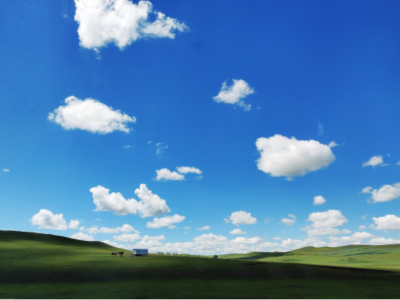
Hulunbuir Grassland
The Hulunbuir Grassland is one of the world's four great grasslands and the most luxuriant natural pasture in China, covering about 100,000 km² and known as the 'Kingdom of Forage.' In summer it rolls in green waves dotted with cattle and sheep, rivers winding like ribbons; in autumn it turns golden under vast skies. The Morigele River is called the 'First Curved Water Under Heaven.' Tribal scenic spots such as Golden Tent Khan and Heishantou preserve traditional Mongol nomadic life, offering horse riding, yurt stays, and Naadam festivals.
Manzhouli Gate & Matryoshka Square
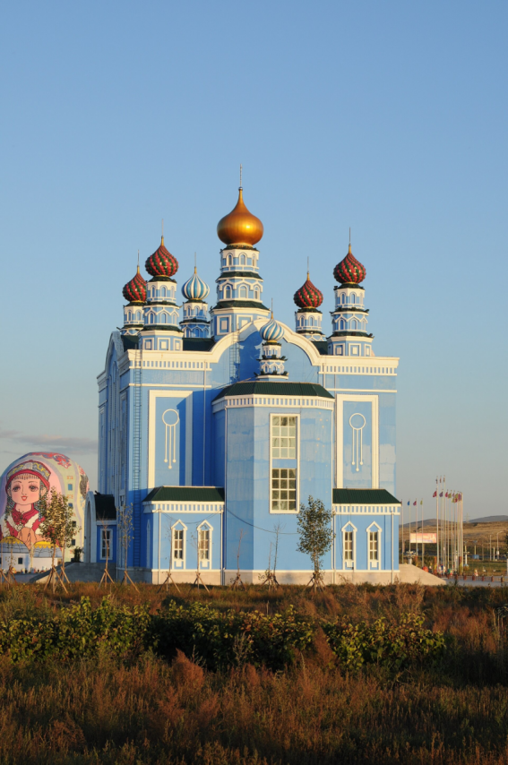
Manzhouli Gate & Matryoshka Square
Manzhouli is China's largest land-port city, bordering Mongolia to the west and Russia to the north and known as the 'Window to East Asia.' The Manzhouli Gate scenic area includes the China–Russia No. 41 boundary marker, successive generations of the gate, and the CPC Sixth Congress Exhibition Hall. The Matryoshka Square is the country's only Russian-nesting-doll-themed leisure plaza, with colorful Russian-style architecture and dazzling night lights—a vivid window into the blending of Chinese, Russian, and Mongolian cultures.
Erguna Wetland
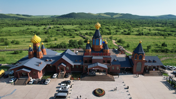
Erguna Wetland
The Erguna Wetland on the outskirts of Ergun City is hailed as 'Asia's No.1 Wetland'—one of China's largest and best-preserved wetlands. The Genhe River meanders through the grassland in nine bends, forming spectacular river-wetland scenery. In spring and summer it is lush with wildflowers; in autumn the forests blaze with color. It is an important habitat for red-crowned cranes, whooper swans, and other rare migratory birds. From the viewing platform one can overlook the stunning scroll of winding waters and intertwined river islets.
Morigele River
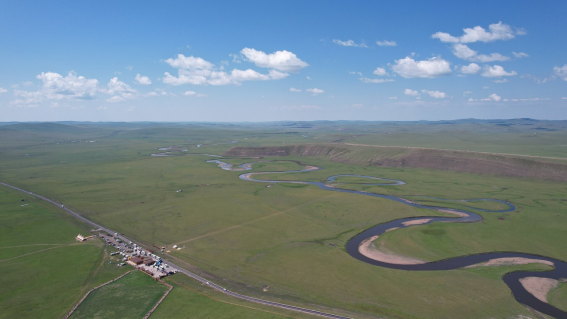
Morigele River
The Morigele River rises on the western slopes of the Greater Khingan Range and flows more than 300 km through the heart of the Hulunbuir Grassland, famed as the 'First Curved Water Under Heaven.' Its waters wind across the flat grassland, forming countless oxbow lakes and bends like silver ribbons set in emerald fields. It is a classic photography spot and an ideal place to experience Mongol nomadic culture, horse racing, and archery.
Lake Hulun
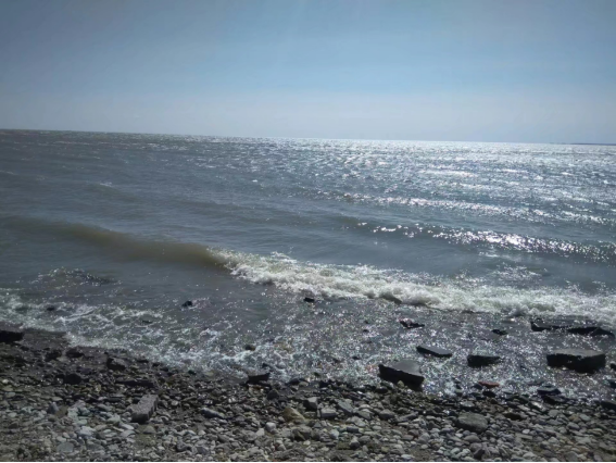
Lake Hulun
Lake Hulun, also called Dalai Lake, lies in western Hulunbuir and is China's fifth-largest freshwater lake and Inner Mongolia's largest, covering about 2,339 km². Together with Lake Buir, it gives Hulunbuir its name. The lake is vast and misty, blending water and sky, with grasslands and wetlands along the shore. It is an important habitat for swans, wild geese, and other rare migratory birds. In summer visitors can boat and taste freshwater fish; in winter the frozen lake offers ice scenery and winter fishing.
Moerdaoga National Forest Park
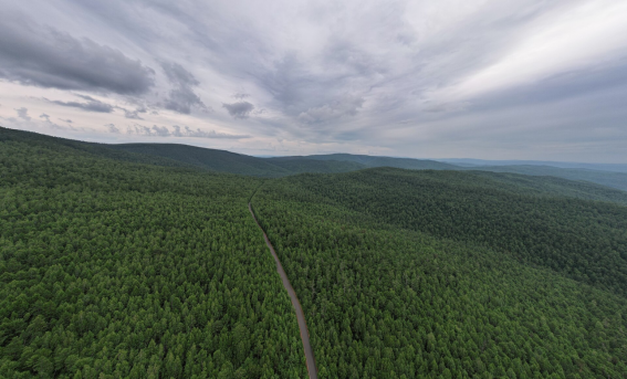
Moerdaoga National Forest Park
Moerdaoga National Forest Park is located in Moerdaoga Town, Erguna City, on the northwestern slopes of the Greater Khingan Range. It is China's largest, northernmost, and longest sightseeing-line national forest park, covering about 1.48 million hectares. Dense forests and winding rivers fill the park; landmarks such as Yimu Jiuling Ridge, Hongdou Slope, and Bailu Island are magnificent. In autumn the forests blaze with color, making it a popular destination for photography and forest wellness. It is praised as 'Xishuangbanna in the south, Moerdaoga in the north.'
V. Cultural Heritage
Hulunbuir's cultural heritage is diverse and profound. The Hulunbuir Grassland is one of China's first national grassland nature reserves. Evenki reindeer herding, Daur field hockey, and Oroqen birch-bark craft are national intangible cultural heritages. Russian settlements in Shiwei and Enhe preserve log houses ('mu-ke-leng') and kulich bread culture, precious homes of the Chinese-Russian descendants. In addition, Zhalainuoer mammoth fossils, Xianbei ancient tombs, and the Heishantou old city ruins tell the long history of grassland civilization.
VI. Ethnic Culture & Folk Customs
Hulunbuir is a harmonious home to many peoples. The Mongols are the most iconic, with Naadam festivals, ovoo worship, long-tune folk songs, the morin khuur, and throat singing expressing the grandeur of nomadic culture. The Evenki are China's only reindeer-herding people, and their 'reindeer tribe' life is fascinating. The Daur are known for field hockey and embroidery, while the Russian Chinese-Russian descendants maintain log houses, kulich bread, and accordion music. Together they paint a colorful humanistic scroll on the grassland.
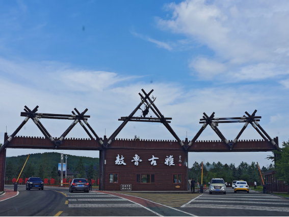
Aoluguya Reindeer Tribe
VII. Local Cuisine
Dish | Description |
Hand-Grabbed Lamb | Lamb boiled in clear water, served with chive-flower sauce or garlic—pure flavor and a Mongol hospitality staple. |
Roast Whole Lamb | A whole lamb marinated and slow-roasted over charcoal, with crispy skin and tender meat—a festive feast for honored guests. |
Milk Tea & Dairy | Brick tea boiled with fresh milk and salt, served with milk skin, milk curd, and fried millet—rich, warming, and nourishing. |
Buryat Buuz | A traditional Buryat Mongol specialty in Hulunbuir—thin-skinned, juicy, generously stuffed with lamb or beef. |
Kumis (Airag) | A mildly alcoholic drink fermented from mare's milk, slightly sour and fragrant—indispensable at grassland festivals. |
VIII. Crafts & Specialties
Hulunbuir's crafts are full of grassland spirit. Mongol knives, saddles, and horse gear are finely made; the morin khuur is the soul instrument of the Mongol people. Birch-bark utensils, animal-skin paintings, felt art, and leather paintings show ingenuity. Local dairy products (milk skin, milk curd, butter, dried milk), air-dried beef, wild blueberry jam, mushrooms, and wood ear are wonderful grassland souvenirs.
IX. Getting There
Transport: Hulunbuir Hailar Dongshan Airport and Manzhouli Xijiao Airport connect to Beijing, Shanghai, Harbin, and other major cities. The Binzhou and Yalin railways and several highways cross the prefecture. It is about 2 hours by air from Beijing to Hailar. Grassland attractions are far apart, so car rental or self-drive is recommended after arrival; special grassland-crossing routes are also available.
X. Best Season & Itineraries
Best time to visit: The best grassland travel season is June to September, when water and grass are lush and the climate is cool—ideal for horse riding, camping, and Naadam. Late September brings blazing autumn colors, a golden period for photography. Winter (December–February) offers snow-covered forests, ice-snow Naadam, and reindeer culture experiences.
Recommended itineraries:
· Grassland Classic Three-Day: Hailar — Morigele River — Golden Tent Khan — Heishantou horse riding — Manzhouli Gate/Matryoshka Square.
· Border & Wetland Three-Day: Manzhouli — Erguna Wetland — Shiwei Russian ethnic village — Enhe — Birch Forest.
· Forest & Reindeer Four-Day: Genhe — Aoluguya Reindeer Tribe — Moerdaoga National Forest Park — Arxan (optional extension).
XI. Economy
Hulunbuir's economy rests on animal husbandry, forestry, tourism, and border trade. It is a major production base for beef, mutton, dairy, and fine-wool sheep; dairy giants such as Yili and Mengniu source high-quality milk here. Manzhouli port handles over 10 million tons of cargo annually, a key channel for China–Russia trade. Riding on world-class grasslands, wetlands, and forests, eco-tourism and cross-border tourism are growing. In 2023 regional GDP was about 150 billion yuan, and Hulunbuir is accelerating as a national ecological-civilization demonstration zone and an important node on the China–Mongolia–Russia economic corridor.